Navigation - Flashcards
Post trail update
This page is out of date. After the trek I created a comprehensive set of trail notes that can be downloaded as a PDF for printing. I would recommend using these instead of the flashcards detailed below, which were often rather out of date. See the Trail Notes page.
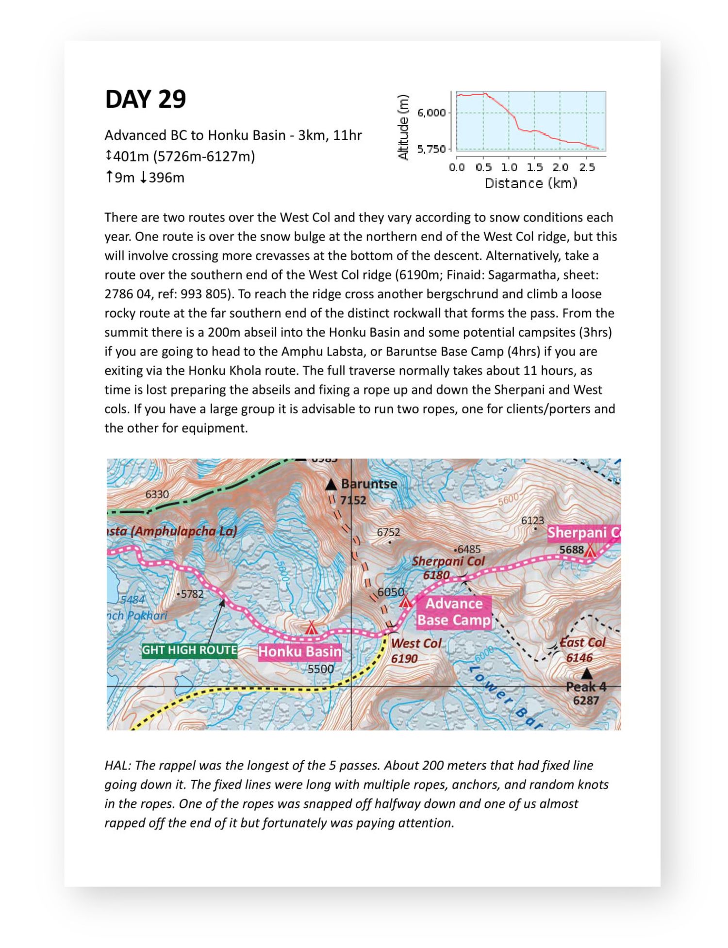
Robin's guide book is excellent, but not organised optimally for a thru-hike of the GHT. I created a set of flashcards, one for each day of our itinerary. They are intended to be printed on A5, double sided. Included in each page is:
- The description from Robin's guide book.
- Additional description from Himalaya Adventure Labs (marked with HAL).
- A crop from the Himalaya Map House 1:150k raster map.
- Stats from the GPX route including elevation range, min, max, total ascent and descent.
- An elevation profile graph for the day from GPSies.
I'm intending to use these paper flashcards as our primary navigation for the simple sections, only referring to the GPS topo maps when we need to. Here's an example page:
The flashcards contain content from Robin's guide book and also the Himalaya Adventure Labs trail notes, so I can't distribute them freely as a download. I'm happy to send you a copy if you get permission from both Robin and Seth.
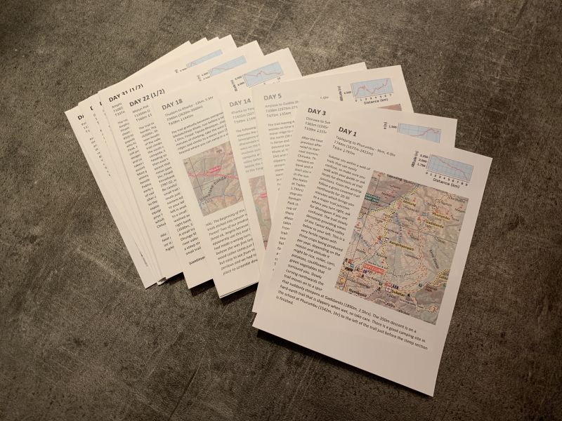
I had a set printed on waterproof 115gsm Xerox NeverTear paper by ColourGraphics. I couldn't be happier with the results - they're perfect:

Dave
Normally a software engineer, recently I've been spending a bit more time in nature.
