Navigation - Sources
Post trail update
This page is out of date. For my latest recommendation on navigation sources, see the FAQ: What navigational sources would you recommend?.
Navigation is critical for any expedition, and especially those venturing into remote areas where the trail network is more tenuous. You'll realise I'm a great believer in technology - however I'd like to point out from the outset that a paper map backup is always required.
In this article I'm going to go through some of the sources that are available for navigating the the 1300km Great Himalaya Trail. This posed my biggest navigation challenge to date. The distances are vast and the trails are often not even marked on the most detailed maps available.
Guide book
Post trail update
The guide book was occasionally useful, but the detailed descriptions were often rather out of date.
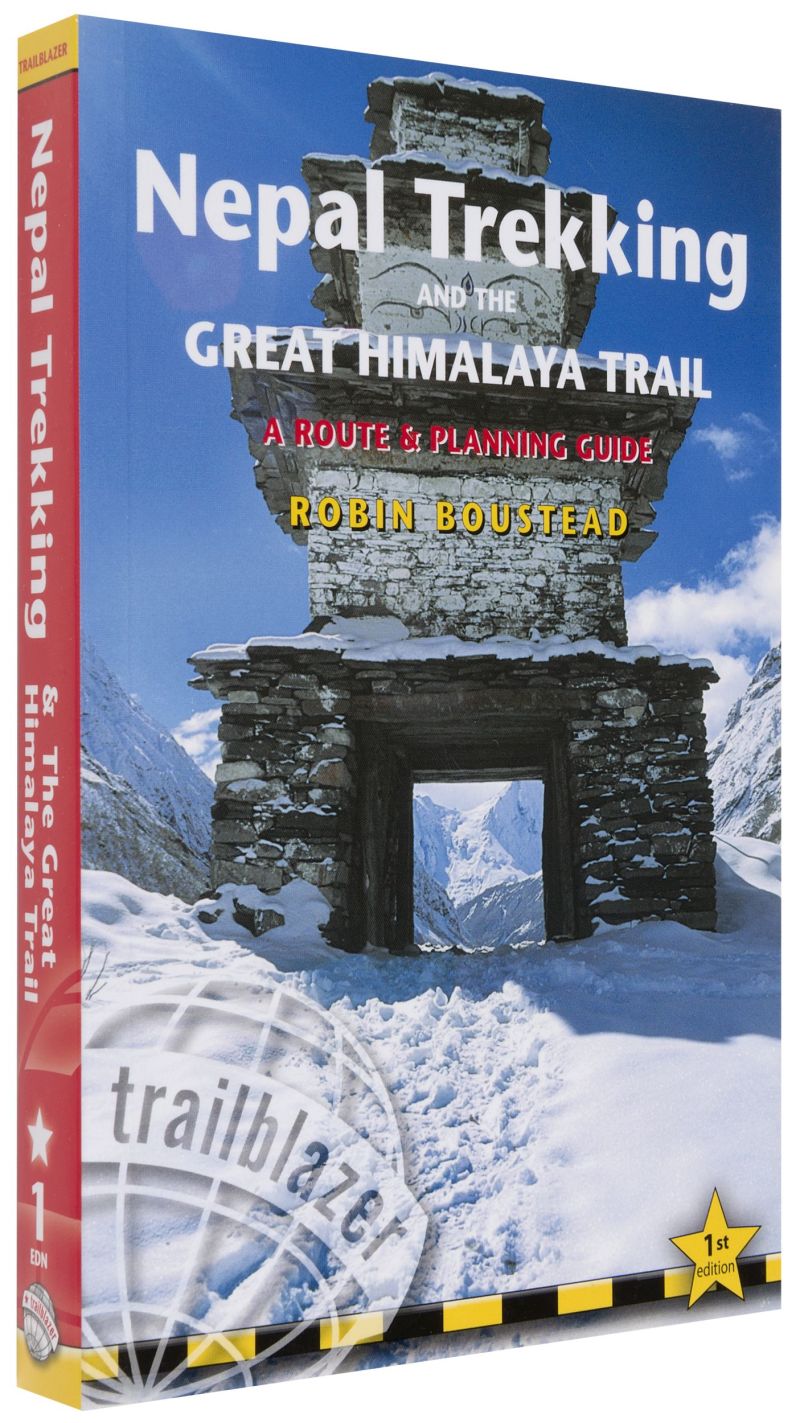
The guide book from Robin Boustead is the best source I've found about the GHT. Robin essentially invented the Great Himalaya Trail, and pioneered the route which links up more established trails with the more remote areas and high mountain passes. The guide book has a detailed itinerary and descriptions for each day. Here's a link.
Himalayan Adventure Labs
Post trail update
The Himalayan Adventure Labs GPS tracks were useful to compare with other routes, however probably less so now I've published updated and improved GPX routes. I would recommend using my latest GPX routes as your primary navigation route. See the Trail Notes page for the latest GPX files.
Seth Wolpin and friends over at Himalayan Adventure Labs have some great GPX files, notes and tips from their 2014 trek. You can find them at www.himalayanadventurelabs.com.
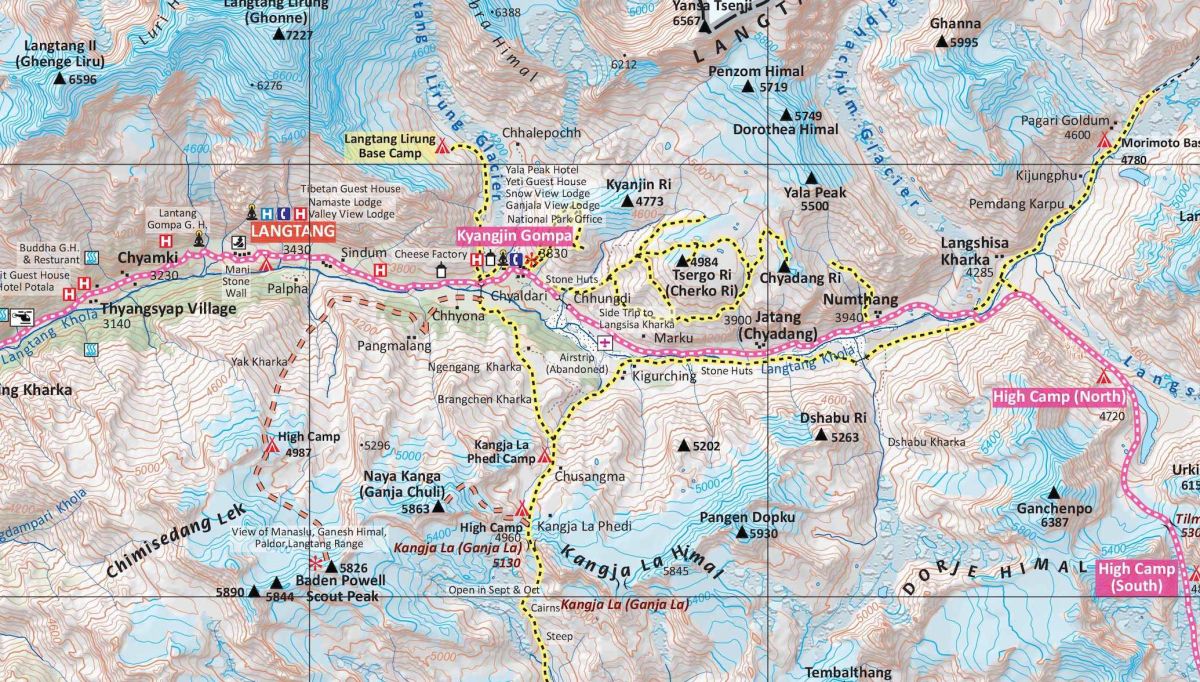
Himalaya Map House topo maps
Post trail update
The Himalaya Map House topo maps are excellent and you should definitely buy these.
These excellent maps are co-produced with Robin, and include the GHT route as well as many other hiking trails. One caveat is the maps are 1:150k scale, so not exactly ideal for detailed navigation. Paper and digital versions are available from Robin's site www.greathimalayatrail.com. Be aware the paper versions are shipped from Nepal so will take a couple of weeks to arrive. The digital version is split into 12 jpg files, each is approx 10k x 6k resolution.
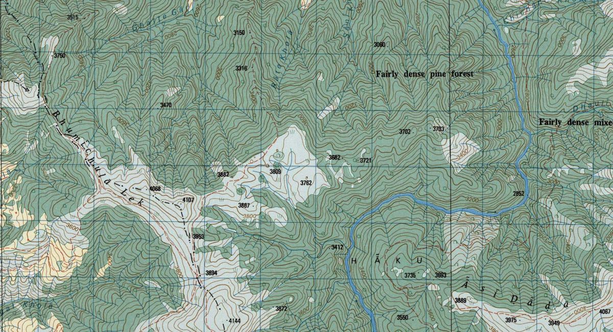
FinAid maps
Post trail update
We didn't use the FinAid maps.
The most detailed topographic maps of Nepal were produced in 1996 from aerial photography in collaboration with the government of Finland. The north of the country is covered by 1:50k scale maps, and the accuracy of the topographic features is excellent. However, the quality of the other information - trails, place names is sometimes less than ideal. In addition, the maps aren't based on the modern WGS84 geographic reference system, so can't be easily geo-coded for display in a GPS app. Paper copies of the maps can be purchased in Kathmandu (from Maps of Nepal in New Baneshwor, near the Everest Hotel). Digital copies of the maps are available for download here. A set covering the GHT route totals about 120 jpg files, approx 8k x 7k resolution - over 1GB in total. If anyone has any good ideas on how these digital maps could be best presented in a mobile app, I would love to get in touch!

Dave
Normally a software engineer, recently I've been spending a bit more time in nature.